Monday, June 9, 2014

Virgin River Gorge Trails - Mt Carmel Junction

 I almost don't want to post this one as I want to keep it all to myself.

If you have an atv or bike and want to see some amazing scenery in southern Utah this is it!
If you have your own atv enjoy and keep it beautiful, if you don't - there are outfitters that can take you on day trips out of St George area.

Ready to head out and on the trail
Directions: Mt. Carmel Junction on hi-way 89South, just south of Mt Carmel there are some roads off to the right and the trails just go all over, crossing the Virgin River multiple times offering sandy trails, river crossing, slot canyons, desert trails through cedars, panoramic views etc.

Duration: hours to days if you want

Difficulty: easy to difficult
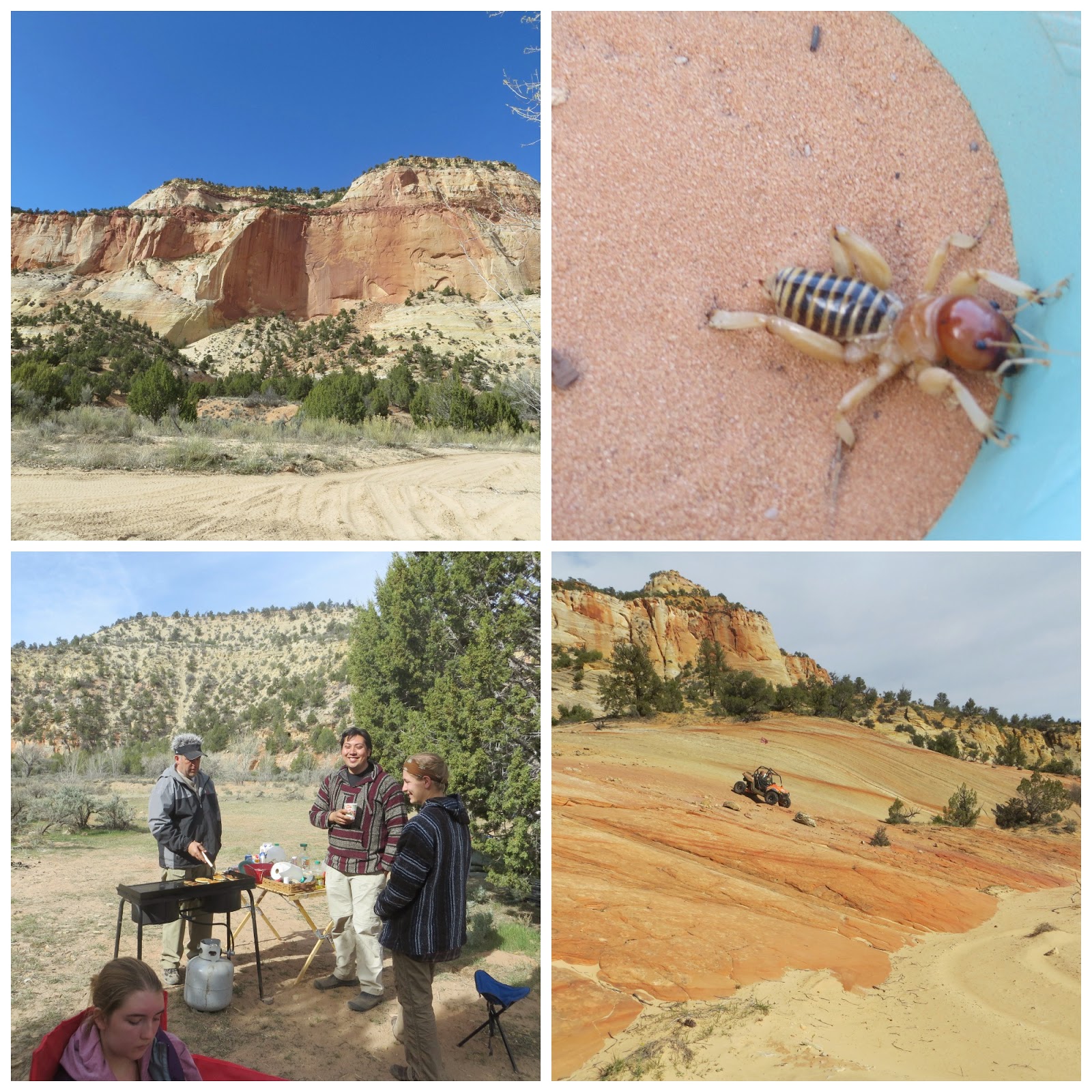
views from the camp both looking out and having breakfast. the little guy is a Jerusalem Cricket
There is a little practice race track right off the road (great for kids learning to handle a machine) as well as primitive camping for tents or trailers.

Special Considerations: Respect the area and signs posted. Keep the area clean.
Bring all the necessary stuff for a day trip remembering you will probably get wet, possibly be cold, windy, very hot and sunny, dry. You may need first aid, winches, shovel to dig out, binoculars to watch birds, mountain goats, other wildlife, camera's, maps, gps, etc.

This trail ends up at Coral Pink Sand Dunes, for which you would need to have a flag to ride and pay the fee. Great Maps are available for a small fee at the ranger station.
The locals are friendly and helpful. Thunderbird Lodge is right up the street should you n eed anything or if you want to stay at a hotel or even hit a round of Golf. Good food at both restaurant choices.


Manti La Sal Arapeen ATV Trails out of Mayfield

Directions: South of Manti on 89 left into Mayfeild and continue up the road where there are several staging areas.
Here is a link to some other trails in the same area - they are all beautiful and make good riding.
http://sanpete.com/pages/atv_map


Duration: All day

Difficulty: Easy to difficult depending on the route and conditions

Special Considerations: Take warm clothes as you go into the higher elevations it gets pretty cold in the early spring/summer.
What to bring: A shovel, first aid kit, food, water, sunscreen, maps, communication devices, camera, binoculars, gps, fishing gear and license.
This area has beautiful views, lakes, challenging trails, ample wildlife (we saw elk and deer and other critters - did not see any snakes) and lots of trees, flowers, vegetation and birds.

Camping is available either rustic or at Palisades State Park - which is another entry all of its own!

Battle Creek out of Pleasant Grove

Location: Just east of Pleasant Grove

Directions: Go east on 200 S Pleasant Grove/ also known as Battle Creek Drive

Difficulty: medium - its a gravel path and it almost entirely uphill with an easy grade most of the time - a little steeper at the end.

Duration: about 1 1/2 miles makes it about about an hour and a half leisurely hike from the park trail head and back if you don't hang out at the falls

Special considerations: There is a really nice picnic/ bbq area at the park by the trail head but I found the bathrooms to be totally unacceptable - and I am pretty liberal in what I consider to be an ok facility. We didn't picnic or bbq - just hiked as our kids were rappelling and we came along to watch and take pictures. We were a little slow getting there so - no rappelling for us. But they had fun and so did a lot of other people.
Dog Friendly - leashed and pick up after your pet.
Good for rappelling as there are hooks in the rock at the top. Not too high, not too little, a little free rappelling over the overhang and you will probably get a little wet with the spray depending on the time of year and how heavy the flow of the water is.